Наши проекты
При создании супербыстрого зарядного комплекса были использованы передовые энергетические технологии и инновационные решения в сфере розничной торговли
Настоящим проектом предусматривается замена резервуара вертикального стального для хранения пироконденсата гидростабилизированного
Проект по разработке фирменного стиля для зданий АЗС, нефтехранилищ, складов и стандартов оборудования.
Наши новости
23.09.2025
Государственное предприятие "Белоруснефть-Нефтехимпроект" приняло участие в V Индустриальном форуме по цифровой трансформации промышленности
25.06.2025
Государственное предприятие "Белоруснефть-Нефтехимпроект" приняло участие в III практической конференции «Инновационное развитие строительного комплекса в Республике Беларусь. Цифровизация. Экспорт. Качество»
Заказчики говорят о нас

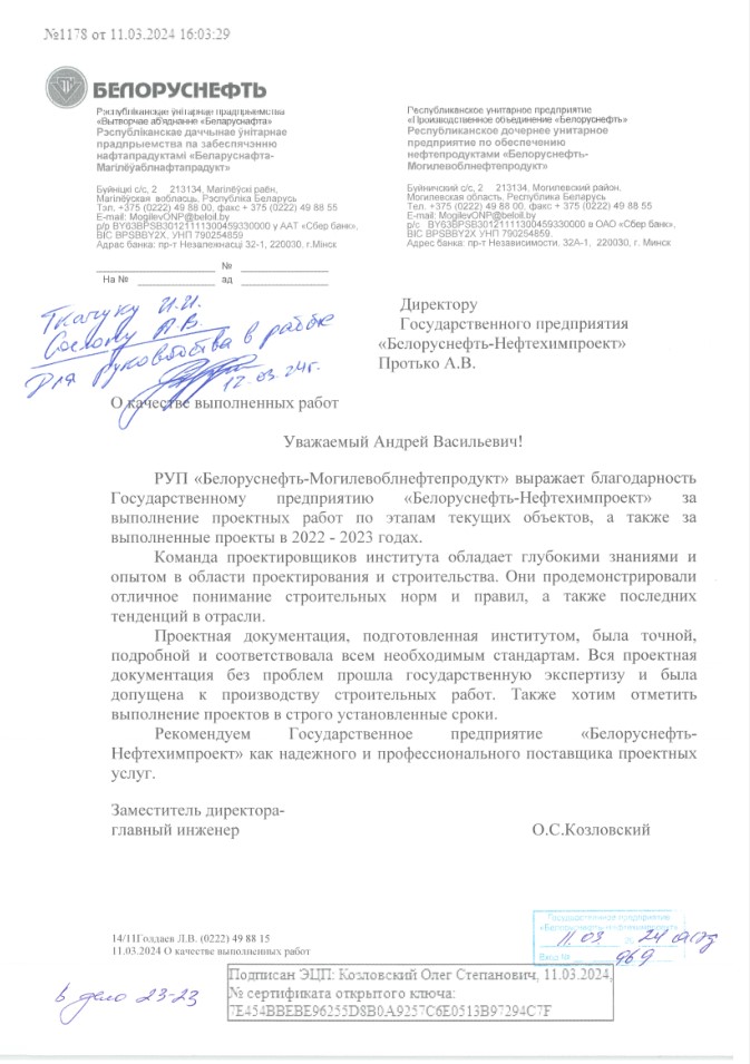
Отзыв от РУП Белоруснефть-Могилевоблнефтепродукт
Письмо № 969 от 11.03.2024

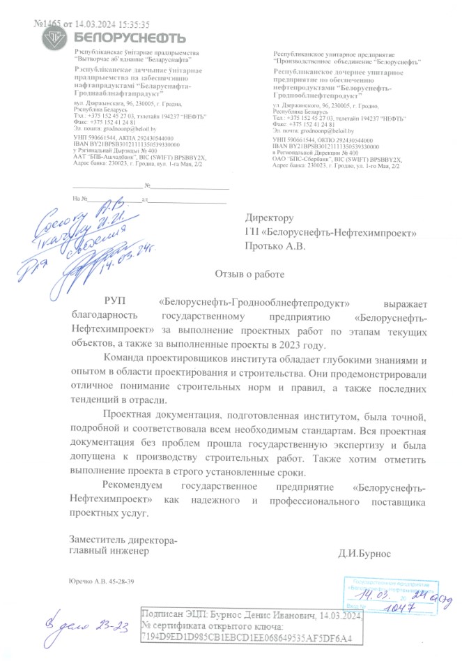
Отзыв от РУП Белоруснефть-Гроднооблнефтепродукт
Письмо №1047 от 14.03.2024
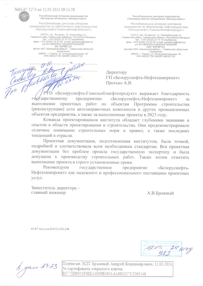
Отзыв от РУП Белоруснефть-Гомельоблнефтепродукт
Письмо №982 от 12.03.2024