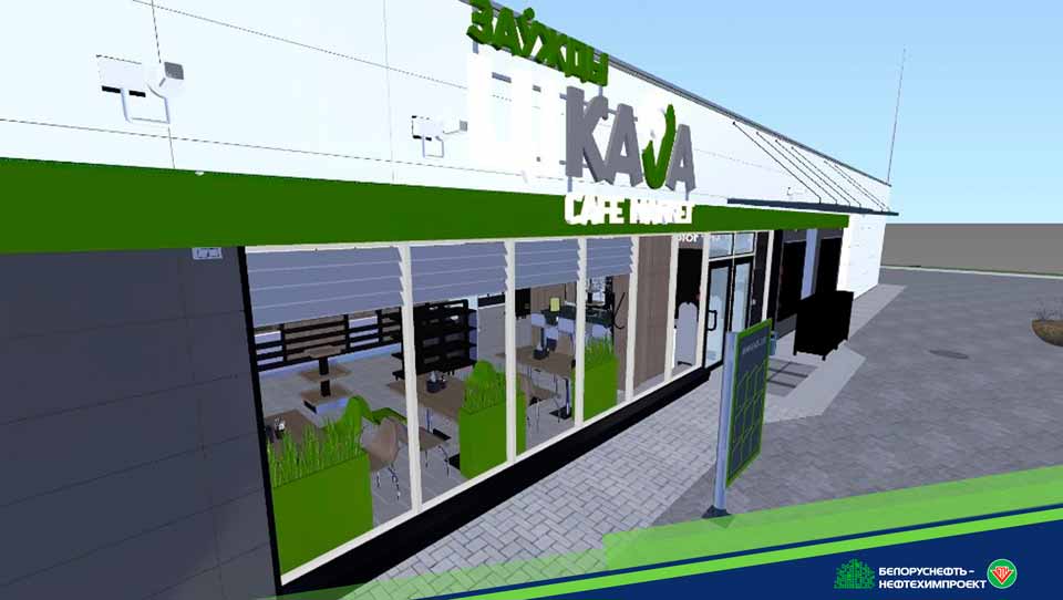
One of the projects developed at the state enterprise Belorusneft-Neftekhimproekt with the use of information modeling technologies is the refueling station No. 30 in Baranovichi city, Republic of Belarus.
At the first stage of the work, specialists of the Geodetic survey Department developed a digital terrain model with existing underground utilities. The model served as the basis for the development of a section of the master plan, which included a digital terrain model of the planned site, small architectural forms and road signs. The section was developed using the Autodesk software product – Civil 3d.
So, within the framework of this project, for the development of outdoor networks and equipment on the site, specialists used a product atypical for these tasks - Autodesk Revit. This decision was justified by the detailing of high-tech sites, the precise coordination of the placed equipment and pipeline networks, as well as the need for direct interdependent information communication between the communication systems of internal and external networks
The Autodesk Revit product was also used to develop architectural and planning solutions, design, technological section, and all engineering communications of the gas station building
To solve some routine tasks, in order to automate the design, specialists used the capabilities of the Dynamo visual programming plugin built into Revit.
All elements of the model are created with a high degree of detail (mainly above LD 300), filled with correct information and geometric information.
he consolidated information model was assembled and checked for collisions using the Autodesk Navisworks software product.
Based on the developed models, specialists have developed associatively related documentation, issued in accordance with the norms and requirements of the Republic of Belarus
As part of the creation of a BIM model, work was carried out on the adaptation of the "ABC-RNTC" computer program for the development of resource and cost estimates of construction projects. Specialists have worked out the parameters necessary for the correct interaction of programs. This made it possible to automate the development of the estimated section by approximately 50% (the program is not adapted for models developed in Civil).
The work of all project participants was organized in a common information environment – Vitro-CAD.